John Cary
John Cary (b.1755 - d.1835) was one of the finest English cartographers. Besides county maps his work covered world atlases, road maps, sea charts, town and canal plans. He became Surveyor of Roads to the General Post Office, commissioned to survey the roads of England in 1794.
John Cary came originally from Wiltshire, the son of a maltster. He was born in February 1755, the second son of George and Mary Cary. He had three brothers, Francis (1756-1836) also an engraver, William (1759-1825) a map publisher and globe maker with whom he collaborated, and George (d.1830) who had premises as a haberdasher in the Strand, London (1820). His two sons, George the younger (d.1859) and John, joined the firm in 1820. The business passed to G.F.Cruchley c.1844, and later to Gall & Inglis.

John Cary’s first county atlas, New and Correct Atlas, appeared in parts from 1787 to 1789. Originally the plan was to publish one part a month, each to include 4 counties, and Devon appeared in issue seven with Somerset, Shrops and Northants on February 26th 1788 (the first title page imprint was dated 1787). Later progress was slow and the final maps appeared in Spring 1789. Atlases were made up of whatever sheets were available. Devon was re-engraved before 1809.
In 1789 he produced maps for an edition of Camden’s Britannia translated by Richard Gough (folio, in 3 Vols with 60 maps). This does not seem to have been very successful, although it was issued a second time in 1806. Meanwhile, however, the maps from this work were used by John Stockdale in his New British Atlas published in 1805. The map of Devon was drawn by E Noble.
Cary’s Traveller’s Companion appeared for the first time in 1790 (small 8vo, 43 maps) although many maps, including Devon, were dated 1789. The Companion was extremely successful and was reprinted many times. Most counties had substantial revisions and, like Devon, were completely re-engraved for the 1806 and 1822 issues (illustrated above).
The maps in each edition of Traveller's Companion are perfect examples of his craft. They combine simplicity of design with maximum of accuracy. After the elaborate designs of the seventeenth century and the first half of the eighteenth they may even strike one as too plain (compared with Moll and Read from the early 1700s for example).
One of Cary´s innovations was the introduction of latters of the alphabet where a main turnpike left the county. This could then be matched up with the corresponding letter on the map of the adjoining county.
Whereas most of the cartographers of the time produced maps showing one specific area or produced atlases with separate counties, Cary produced two atlases based on sectional maps which could be placed next to each other to form a map of England and Wales; these were the New Map of England and Wales and the Improved Map. While the first only appeared in two editions the latter was so successful it was not only reprinted several times but sections were extracted and adapted to suit local needs.
For Cary´s county maps refer to The Printed Maps of Devon entries 51, 54, 55, 69, 71, 73 and 92. Click reference number to open directly.
For Cary´s New Map of England and Wales so-called "square atlas" - click here.
For Cary´s Improved Map of England and Wales as issued by Cary and others - click here.
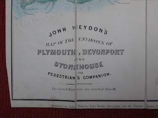
For the section of Improved Map of England and Wales as issued by John Heydon - click here.
For the section of Improved Map of England and Wales as issued by A H Swiss - click here.
For the section of Improved Map of England and Wales as issued by Arthur Westley - click here.
For the section of Improved Map of England and Wales as issued by Thomas Doidge - click here.
For the sections of Improved Map of England and Wales as printed by Gall & Inglis for two Exeter companies (Henry Eland and Standfield & White) click here.
For the 2 sections of Improved Map of England and Wales as used by Beatrix Cresswell - click here.
For the section of Cary´s Reduced Ordnance Map of England and Wales as issued by G F Cruchley to show Dartmoor Maneouvres - click here.
To return / access the Catalogue of Maps in this work - click here