James Fawckner Nicholls
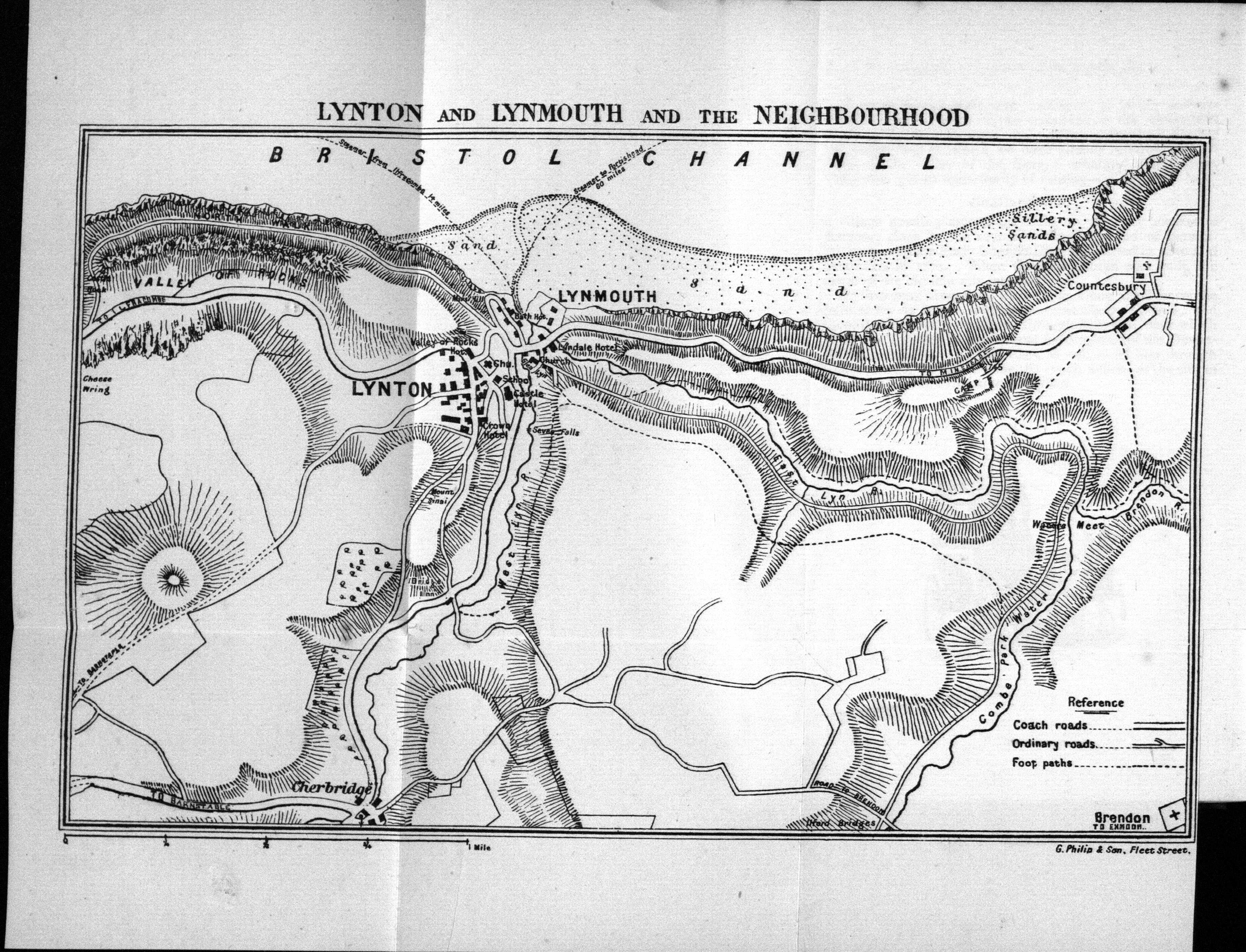
The map and guide below was contained in Nicholls’ Guide, or Pleasant Rambles Round About Lynton & Lynmouth, together with the different routes to North Devon written by James Fawckner Nicholls (1818-1883), English antiquarian and the Bristol City Librarian and author of a number of books on Bristol and the surrounding area. Nicholls had Devon connections: he was born Sidmouth and went to Kentisbeare for his schooling. He had many different jobs before returning to the westcountry; draper in Berwick, school owner in Ramsey, travelling salesman in Manchester. Finally he was appointed city librarian in Bristol in 1868. His writings were recognised and he was elected a fellow of the Society of Antiquaries of London in 1876.[1]
The printer and publisher was J W Arrowsmith of Quay Street, Bristol. James Williams Arrowsmith had only recently taken over the family business from his father, Isaac Arrowsmith. The company was started by Isaac in 1854 and the company remained in business until 2006. Its most famous publication was Jerome K Jerome´s Three Men in a Boat (to say nothing of the dog) (1889), but they also published W G Grace´s Cricket (1891). Google Books has a sixteen page catalogue of J W Arrowsmith´s offerings of 1888.
The text of the guide described here was probably written in the autumn of 1874 (the last date in the text records the North Devon Railway opening on July 16th of that year) and the first edition published shortly after. There was a second edition circa 1879 .
Size: 150 x 220 mm. No scale.
No title. Printer’s signature: Arrowsmith, litho, Bristol (EaOS).Railway from Taunton to Barnstaple and Bideford. The line to Ilfracombe is only inserted as far as Slade (reached Ilfracombe in July 1874). Inset map of Lundy. The map is adapted from an OS map (as mentioned on both the title page and cover of the guide). For picture credit see below.
1. 1875 Nicholls’ Guide, or Pleasant Rambles Round About Lynton & Lynmouth, ...
Bristol: Arrowsmith. Lynton: Jose. (1874). [DevA], [NDR].
Nicholls’ Guide, or Pleasant Rambles Round ... Second Edition
Bristol: Arrowsmith. Lynton: Jose. (1875). BL.
Nicholls’ Guide, or Pleasant Rambles Round ... Third Edition
Bristol: Arrowsmith. (1879). BL (lacks map), [DevA].
Nicholls’ Guide, or Pleasant Rambles Round ... Fourth Edition
Bristol: J Arrowsmith. (1885). [P] (internet seller 2022).
NOTES:
[1] https://en.wikipedia.org/wiki/James_Fawckner_Nicholls.
[2] Subsequent editions only have "Second Edition" etc. on the paper outside covers, not on title page.
The illustration is courtesy of the Trustees of the British Library and is provided by Google Books, hence subject to the Google Terms and Conditions. Not for use without acknowledgement.