The Ordnance Survey – Tourist Maps (combining multiple sheets)
The Ordnance Survey were still selling their original first generation sheets
of Devon as produced by William Mudge in 1809 (see B&B 74) towards the end of the 1800s. They were now cheap to
produce being Printed from an Electrotype
and sold by a number of mapsellers such as Letts, Son and Steer and in various combinations of
sheets, often in slipcases. But steadily, throughout the 1890s, the OS was busy
resurveying the county. The individual sheets were obviously being printed but
to what extent they were put on sale is still uncertain. However, as well as producing
the individual sheets from the revised one inch survey and derivatives, such as
combined double and quarter page maps, a few areas were covered especially by the
Ordnance Survey and awarded special folding map status in their
own covers.
At the same time the OS were selling sheets at 1:500 and Edwin Chapple, Government Agent for Ordnance Survey Maps in Plymouth, was advertising
various towns in Devon and Cornwall at this scale, e.g. Plymouth, Devonport and
Stonehouse on 79 sheets. The 1:2500 series was also on offer as well as the 6”
to a Mile as so-called quarter sheets. These maps were not designed primarily
for tourists and have not been covered in this work.
However, Chapple was advertising the 1” to 1 mile scale maps as very useful to tourists, pedestrians, and
cyclists just before the turn of the century. As can be seen from the maps
listed here the Ordnance Survey were busy revising their maps in the late
1890s; Plymouth was revised 1894, Dartmoor in 1896 and Torquay and North Devon
in 1896-7. These areas were treated specially with the production of maps which
included multiple sheets (e.g. Dartmoor) or combinations of sheets and part
sheets (e.g. Plymouth and North Devon) of the full survey. Chapple was also advertising
maps of Bideford, Holsworthy, Tavistock, Exeter[1]
and Ivybridge at this scale but these have not yet been identified, but
presumably were also available in this format designed for early tourists. More
maps are likely to be found.
Chapple was obviously keen to secure all OS business and his flyer
(found, for example, in the Plymouth and Dartmoor maps) has: The Government
has established these Agents in all the larger towns throughout the Kingdom,
with the desire to make the Maps more easily and readily accessible to the public,
and it is hoped that every support will be accorded to the Local Agent, who is
in a better position than any other person to supply the Maps of the District.
The other agents for Devon seem to have been H S Eland at 236 High Street, Exeter and Mr
Andrew Iredale in Torquay.
Brevet
Colonel D A Johnston was appointed Director General of the Ordnance Survey in
1899 but served only a few years. He was appointed a Knight Commander of the
Order of Saint Michael and Saint George in King George’s birthday honours list
on the occasion of his sixty-fifth birthday (1906).
Five maps are included here (others may be found later):
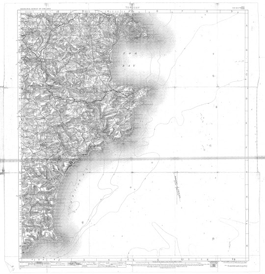
OS 1 - Torquay 1 (1899) - see below
OS 2 - Plymouth 1899 (1900)
OS 3 - Dartmoor (1900)
OS 4 - North Devon (1901)
OS 5 - Torquay 2 (1901)
OS 1 –Torquay 1
Size: 530 x 480 mm. Scale of One Inch to One Statute Mile (8F + 4 = 130 mm) Miles.
TORQUAY (CaOS). Above the map are: ORDNANCE SURVEY OF ENGLAND (AaOS) and SHEETS 350. / 356. (EaOS) with signature: Revised in 1896-97 and Published at the Ordnance Survey Office, Southampton, 1899 (EeOS).
OS sheets 350 and 356 printed as one sheet to form a map of the area surrounding Tor Bay. Scale of 1 inch to mile. Compass with magnetic deviation in margin (EdOS). Area is from St Marychurch in the north to Start Point and inland as far as Harbertonford and Dartington just west of Totnes (printed red waterproof covers with OS crest and reference to sheet numbers).
1. 1899 Ordnance Survey. Torquay.Southampton: Ordnance Survey Office. 1899. TQ.
[1] The British Library has a map
of Exeter (535 x 738 mm) which they date 1899. As the scale is 1" to a mile
it may be one of these. Certainly sheet 93 showing an area from Hatherleigh
(NW) to Tor Bay at two miles to an inch was on sale, possibly from 1896 when it
was reduced from the 1" map, in a red cover as a folding map.


No comments:
Post a Comment